
Precision aerial inspection and infrared thermography. Built for Atlantic Canada's industrial infrastructure.

SNT-TC-1A LEVEL II · TRANSPORT CANADA ADVANCED RPAS · FULLY INSURED
Radiometric thermal and 4K visual, captured in a single pass and interpreted by a certified Level II thermographer. We find the heat signatures that come before failure on transmission hardware, substations, wind and solar sites, and commercial roofs. Every finding is located, ranked by severity and ready for your maintenance plan.
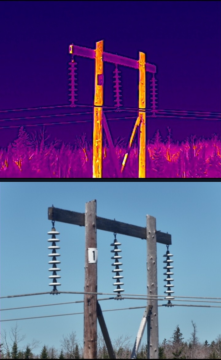
Thermal and visual images of the same transmission structure, showing insulator and crossarm temperatures
≤50 mK
Thermal sensitivity
1280×1024
Radiometric thermal resolution
1600°C
Measurement range, with IR density filter

Equipment rarely fails without warning.

Loose connections, failing splices, overloaded phases, debonded laminate and wet insulation all change how heat moves through an asset before they fail. A thermal survey reads that change while the equipment is still in service — long before it becomes an outage, a fire or an insurance claim.

Thermal and visual, one flight.

Our payload records radiometric thermal at 1280×1024 and 4K visual at the same moment, from a 13 to 50 metre standoff. No scaffolding, no lifts, no outage window. Every thermal anomaly comes with a visual image of the same spot, so your crew knows exactly what they're walking up to.
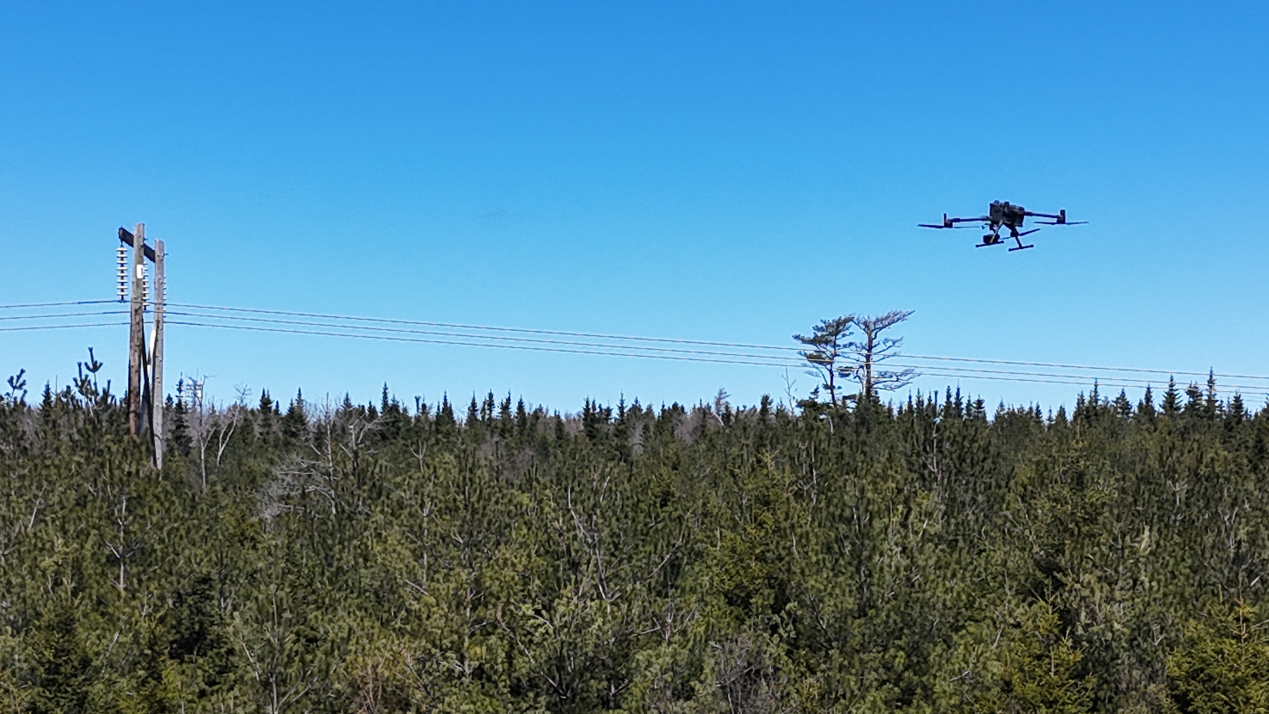
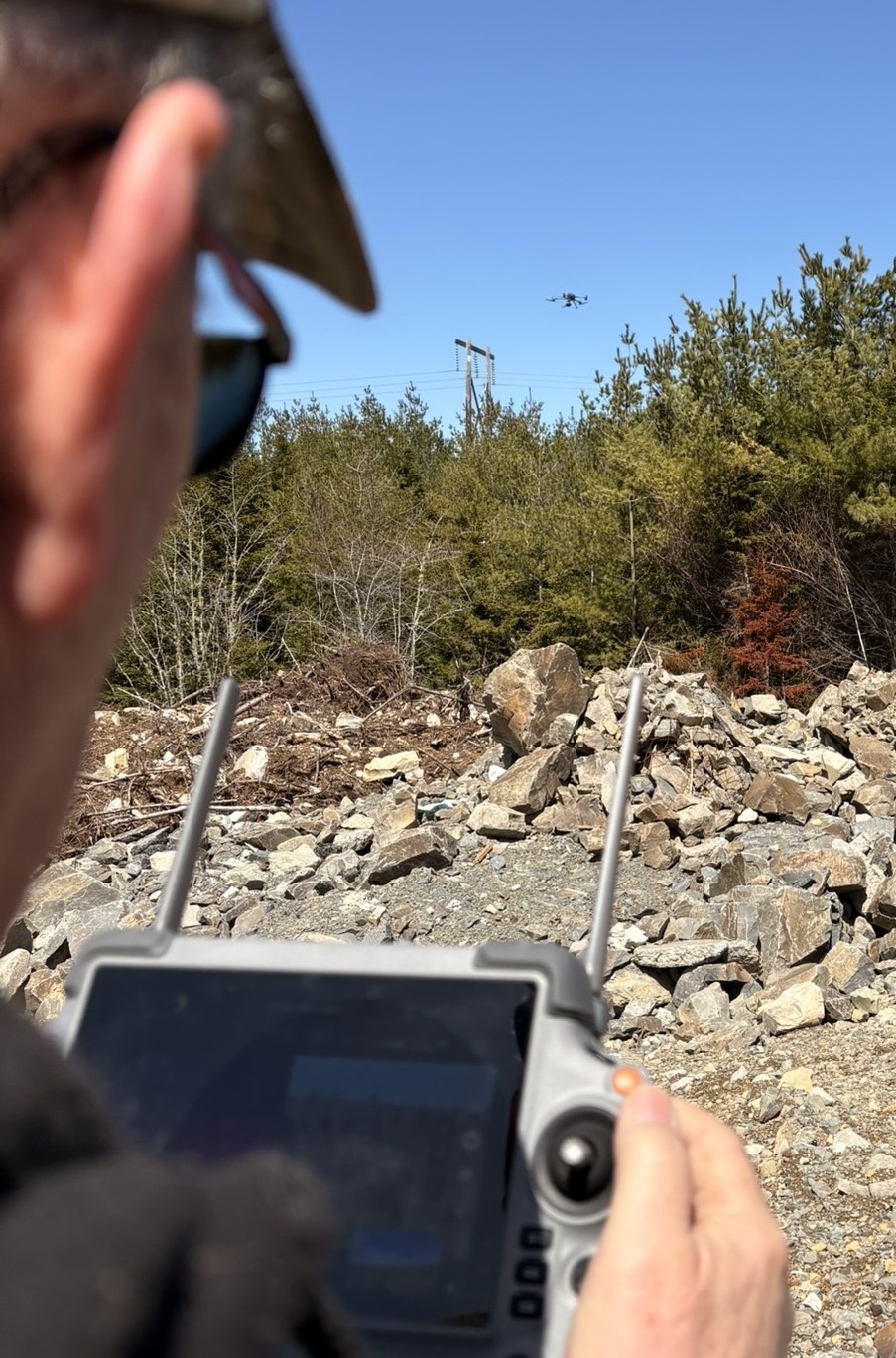
DJI Matrice 400 inspecting a transmission line over forest in Nova ScotiaPilot's view of the controller during an aerial transmission line inspection

From first flight to final report.

Infrared Thermography

Radiometric thermal at 1280×1024 and ≤50 mK NETD. Every dataset is reviewed and interpreted by a Level II thermographer certified per ASNT SNT-TC-1A — never exported raw from the aircraft.

Visual Inspection

4K visual with every thermal frame, plus 34× optical zoom for close detail on insulators, hardware, blade leading edges and roofing, with no climbing or lifts. A laser rangefinder logs standoff distance on every target.

Inspection Reporting

Each finding is located, paired in thermal and visual, and ranked by severity: NETA MTS for electrical assets, IEC 62446-3 for solar PV. Standoff, emissivity and weather are recorded, so next year's survey compares directly against this one.

Sectors we serve across Atlantic Canada.

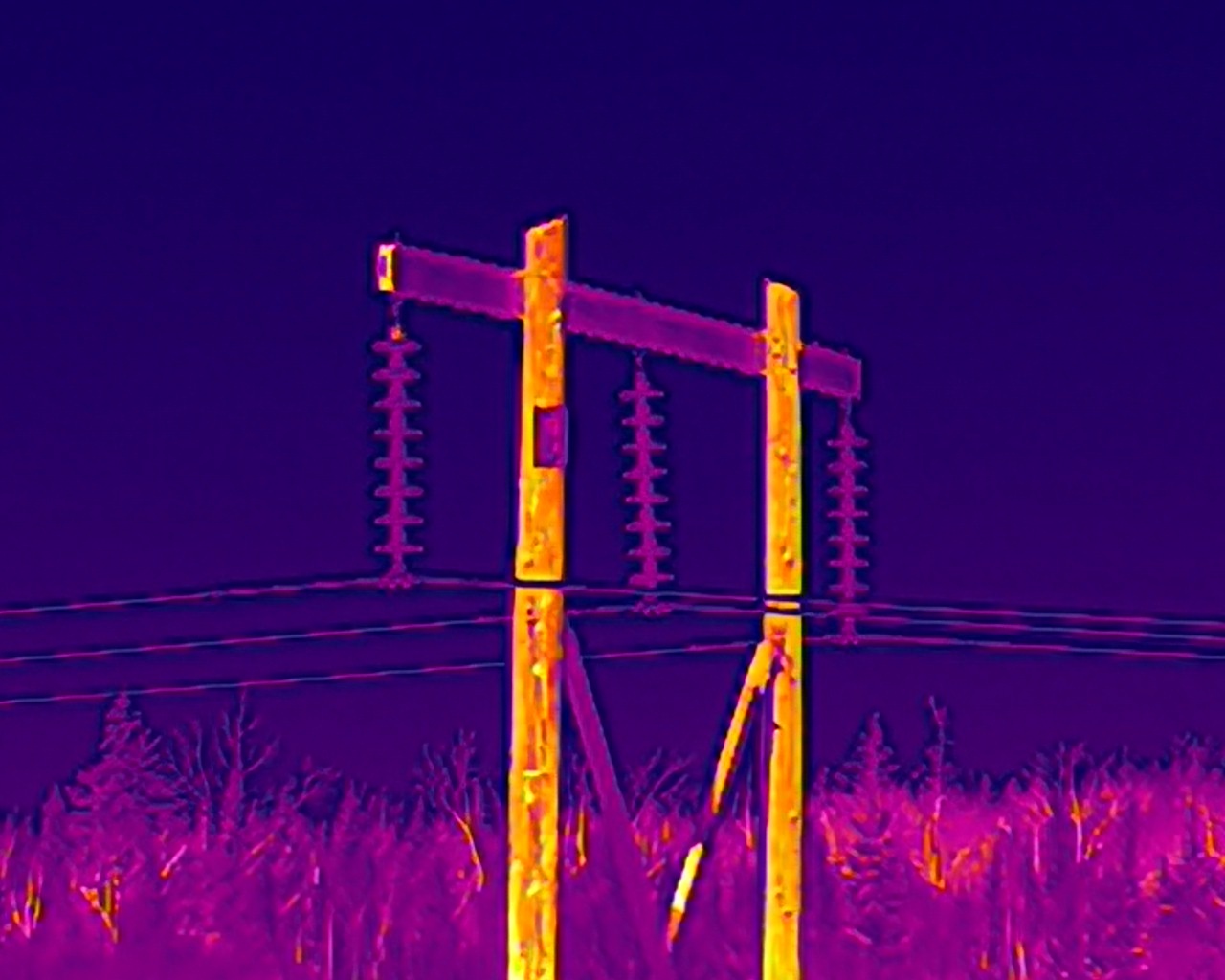
Close-up thermal image of transmission line insulators

Utility Transmission

Lines, towers, insulators and substation hardware, surveyed while energized. We find failing connectors, splices, insulators and overloaded phases. Substation findings are ranked per NETA MTS; overhead line hotspots against industry conventions.
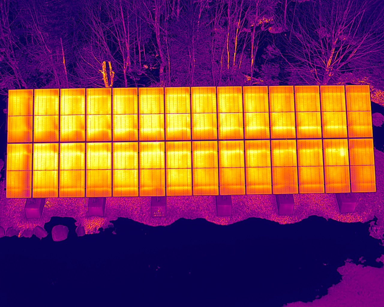
Thermal image of a ground-mount solar array showing module temperatures

Wind & Solar

Solar thermal surveys aligned to IEC 62446-3, flagging failed cells, bypass diodes, strings and connectors. Wind turbine blade screening with the rotor parked, for debonds, delamination and trapped moisture. Balance-of-plant thermography under load: collector system, pad-mount transformers and cable terminations. A first-year baseline gives every future survey something to measure against.

Oil & Gas

Live surveys of flare tips, fired heaters, refractory and tank exteriors, with measurement to 1600°C using an IR density filter. No shutdown, no scaffolding. Exterior screening that feeds detailed inspection and turnaround planning.
Aerial thermal image of a commercial standing-seam metal roof

Commercial Roofs & Claims

Flat-roof moisture mapping, heat-loss surveys and post-loss documentation for property managers and adjusters. Thermal shows where water has spread under the membrane, so cores and repairs go where they're needed. Findings are dated, located and paired in thermal and visual, ready for the claim file. Heat-loss surveys run best in the cold months; moisture surveys are flown on the evening after a clear, sunny day.

Wildfire & Emergency Response

Thermal hotspot detection for mop-up and post-fire monitoring. Radiometric imagery locates smouldering ground and holdover heat that crews can't see from the surface, with every hotspot geotagged and delivered as a map crews can work from. Flown under authorization from the fire agency, inside your incident's airspace controls.

A disciplined process, from scope to report.

Scope

We review the asset, access, safety requirements and the decision you need to make, then set detection thresholds and flight standoffs to match.

Capture

Airspace authorization, written site permission and a safety briefing come first. Then thermal and visual in one pass, with standoff and conditions logged per target.

Analyze

Level II thermographic review per ASNT SNT-TC-1A. Severity classification against NETA MTS criteria for electrical assets, IEC 62446-3 for solar PV, and industry hotspot conventions for transmission and mechanical systems.

Report

Annotated findings, thermal and visual pairs, severity rankings and recommended actions, formatted for your maintenance team and your asset records.

Ready to see what you've been missing?

Every engagement starts with a scoping call. Tell us about the asset and the decision in front of you. We'll tell you what a thermal survey can answer — and what it can't.

Request a Proposal